The end of ReDoCO2: Using Drones and AI to Reduce Peatland CO2 Emissions; But not the end of the mission!
ReDoCO2 is wrapping up the project work and transferring the knowledge into new applications, insights and business cases. We knew already before that peatlands store huge amounts of carbon, but when drained for agriculture they release significant CO2 emissions. In Denmark, cultivated peat soils are among the country’s largest sources of land-based greenhouse gases. The ReDoCO2 project was created to address this challenge using advanced drone technology, geophysics, and artificial intelligence.
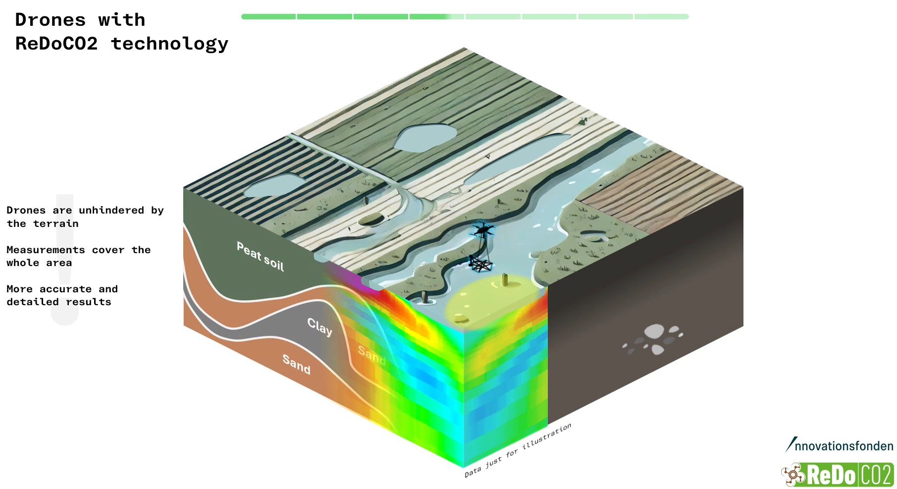
The project brought together Aarhus University, Aalborg University, Region Midtjylland, I-GIS, and SkyTEM to improve how peat soils are mapped and monitored. By combining drone-mounted sensors, 3D geological mapping, and machine learning, the team developed a more accurate way to identify peatland areas and estimate their climate impact.
One of the project’s key innovations is a drone-based transient electromagnetic system capable of collecting detailed underground data quickly and efficiently. This technology helps researchers and policymakers pinpoint which areas would deliver the greatest CO2 reductions if restored or rewetted.
The biggest advantage of ReDoCO2 is precision. Traditional peatland maps often lack detail, making climate decisions less effective. ReDoCO2 provides field-level insights that support smarter land-use planning, better carbon accounting, and more targeted climate action.
The project also highlights the value of collaboration between universities, public authorities, and technology companies. By combining scientific research with practical tools, ReDoCO2 demonstrates how innovation can support real-world climate solutions.
As countries continue working toward ambitious climate goals, the technologies developed through ReDoCO2 could play an important role in future peatland restoration projects across Europe and beyond. Reach out to the members of the project if you are interested in our findings or see if a collaboration could be of interest for your mapping case.